
Mickleton
& Middleton
A complete mile-by-mile route guide for runners and walkers
Distance: 9.14 km / 5.68 mi
Total Ascent: approx. 139 m / 455 ft
High Point: approx. 249 m / 815 ft (the finish, on the old railway at Mickleton)
Low Point: approx. 194 m / 635 ft (the River Tees at Beckstones Wath)
Start/Finish: Mickleton Station Picnic Area car park, Mickleton, Teesdale DL12 0JN
Start Elevation: approx. 247 m / 810 ft
Estimated Time: 55–75 minutes running / 2–2.5 hours walking
Terrain: Variable: village lanes, grassy field paths, narrow and technical riverside singletrack, and a gravel and grass railway trackbed, with plenty of stiles and gates
Recommended Footwear: Trail shoes; deep-lug mud shoes in autumn; in snow and ice, traction devices or don’t run it (see Navigation & Safety)
This is a run of two characters, joined by two very different bridges over the Tees. You leave the old station at Mickleton and drop through the village to the river. Then you pick your way upstream on rough, narrow singletrack to Middleton-in-Teesdale, the North Pennines town the lead miners built. The return comes straight home along the bed of a Victorian branch line, over a five-arched viaduct high above the River Lune.
The numbers look gentle: under 140 metres of climbing in just under six miles. The numbers don’t tell the whole story. The first half is slow, technical running, with stiles to clamber, steps to climb and a riverbank that demands your full attention. The second half is the opposite: a steady false-flat grind up the railway, where rhythm counts for more than footwork. It works as a skills session, a scenic weekend loop, or an honest introduction to Teesdale trail running.
Expect stiles, gates and road crossings throughout, and livestock on most of the route. Follow any signs, close every gate behind you, and keep dogs on leads where asked or near animals. Never get between a cow and her calf. If cattle become curious, walk calmly round them rather than running through.
The riverside singletrack is narrow, rooty and close to the water in places, with constant short rises, drops and steps. It gets slippery after rain, and the river can rise quickly after heavy weather in the fells. Don’t attempt it in spate conditions.
Autumn: Once the leaves come down, the riverside path changes character. Wet leaf litter is as slick as ice underfoot, and it hides the roots, stones, holes and edges you’d normally read and avoid. Combined with the cold, the wet and the endless ups and downs, it turns a technical section into a genuinely hazardous one. Slow right down, hike the steep pitches, and treat every step as one you can’t see.
Winter: Snow and ice on the steps, the steep bank and the narrow riverside path make a slip into the river or down the bank a real possibility. In these conditions, consider avoiding the route entirely. Only attempt it if you are highly experienced and confident on snow and ice, wear appropriate footwear with traction devices, and carry the right safety kit.
Tell someone before you go. Whatever the season, let someone know where you’re going, the route you’re taking and when you expect to be back, and tell them when you’re home. This matters most if you’re running alone, because the riverside section is quiet and an injury there could leave you waiting a long time for anyone to pass. Carry a fully charged phone, a warm layer and a waterproof, a whistle and a headtorch outside the summer months. In an emergency, call 999 and ask for the Police, then Mountain Rescue. This area is covered by the volunteer Teesdale & Weardale Search and Mountain Rescue Team.
Mickleton to the Tees
Miles 0–1 | 0–1.6 km | 194–247 m | ↑ approx. 4 m ↓ 56 m | Tarmac lanes, farm track, field paths
You leave the old station site and head into Mickleton, picking up the main street before turning off on quiet lanes that drop towards the river. It’s almost all downhill. The steepest pitch of the day comes early, with the lane falling at around 8–9% for a short stretch just before the one-kilometre mark.
The tarmac gives way to a broad farm track and then to field paths as the valley floor opens up. Within a mile you’ve dropped more than 50 metres, reaching the lowest point of the route, at around 194 metres, as the Tees comes into view.
Runner’s Note: It’s tempting to bank time on this free downhill mile, but don’t. The descent is on road and your legs will be cold. Everything that follows is slower, rougher and harder, so arrive at the river relaxed.
Beckstones Wath & the Riverbank
Miles 1–2 | 1.6–3.2 km | 196–228 m | ↑ approx. 48 m ↓ 33 m | Footbridge, grass, riverside track, rough steps
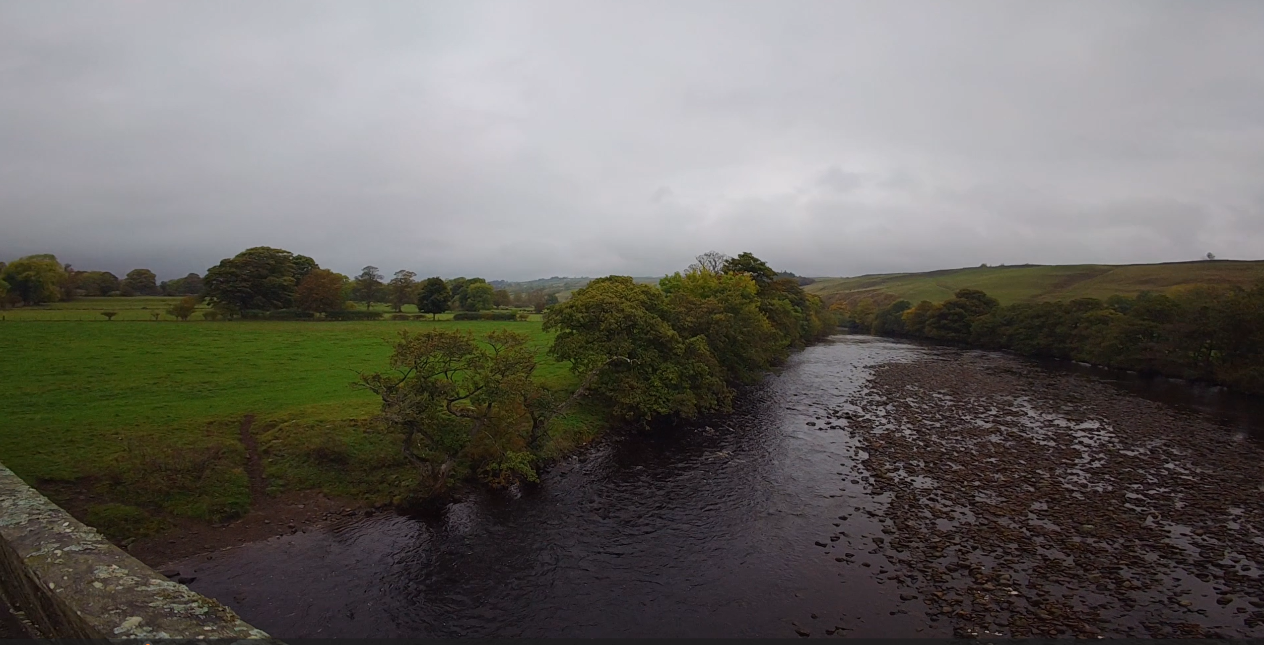
Just past the first mile you cross the Tees on the long Beckstones Wath footbridge and turn upstream along the north bank. A short field crossing brings you to a broad riverside track. The river is now on your left and Teesdale Way waymarks begin to appear along the bank.
Then the route bites. Beyond a field barn the path leaves the water and climbs away from the river on rough steps and a steep woodland bank. Over about 200 metres the gradient touches 12–13%, the steepest climb of the whole loop. It tops out at around 228 metres just after the three-kilometre mark. It’s short, but it’s the one place where you’ll almost certainly be hiking.
Point of Interest — Beckstones Wath Footbridge: This crossing, also known locally as the Millennium Bridge, was the result of a campaign by residents of Mickleton and Eggleston that began in the 1980s. When it was completed around the turn of the millennium, it was described as the first new bridge over the upper Tees in more than 200 years. Today it’s the vital link that lets this loop, and the Teesdale Way, cross between the two sides of the dale.
Runner’s Note: Power-hike the steps with your hands on your knees, then reset your breathing at the top. The ground is about to get technical, and you want your head clear for it.
The Singletrack Above the River
Miles 2–3 | 3.2–4.8 km | 207–216 m | ↑ approx. 25 m ↓ 26 m | Narrow technical singletrack, grassy field paths, stiles
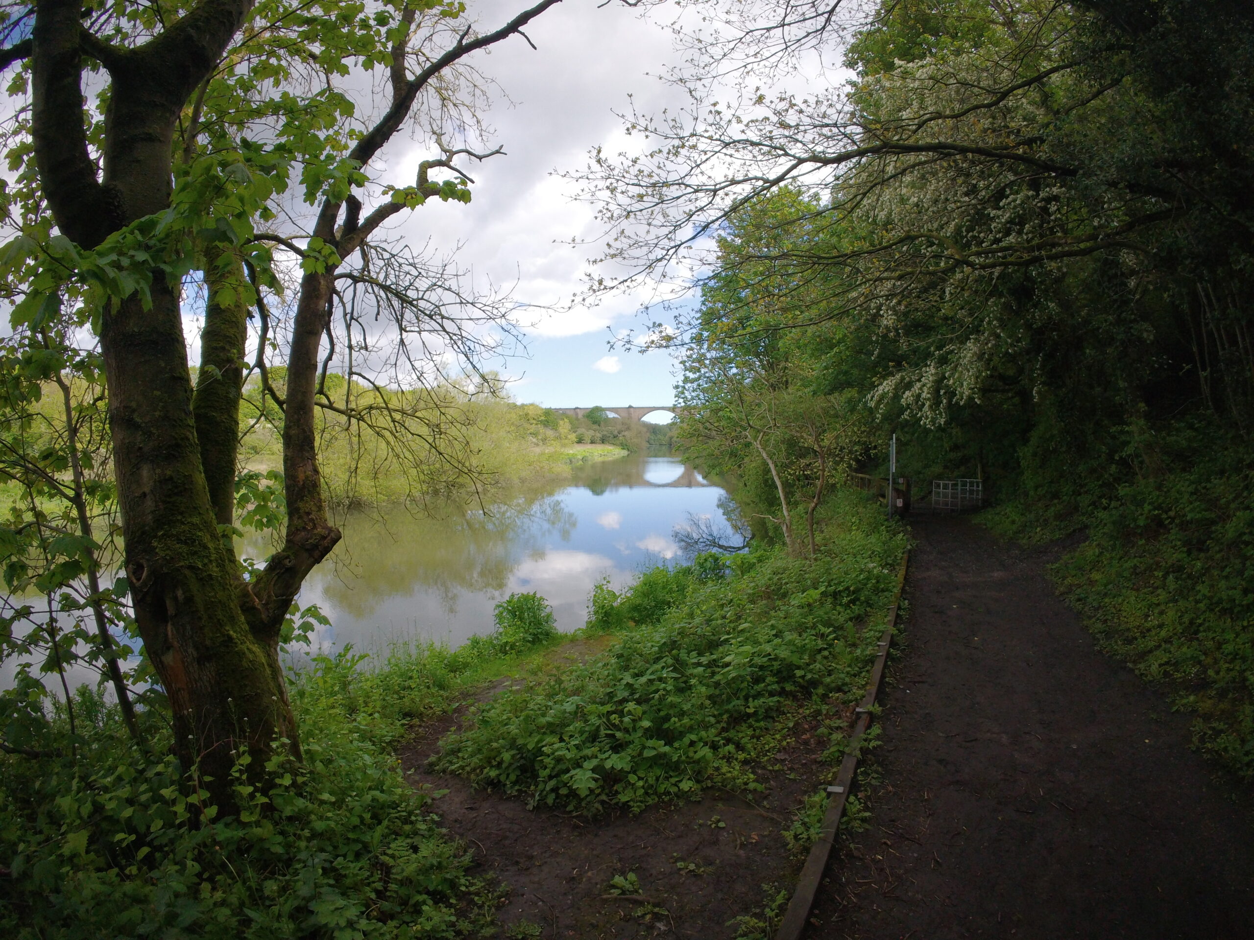
This is the heart of the route and the reason to bring trail shoes. The path runs as a narrow ribbon of singletrack along the bank high above the Tees, constantly rising and dipping over roots, stones and short, sharp steps. The total climbing in this mile is modest, but the rhythm never settles. Expect to brake, step and hop your way through.
Gradually the path eases out onto grassy field edges near the top of the slope, with stiles at almost every boundary. The views open up the valley as you go, with Teesdale’s patchwork of walled fields climbing towards the fells and a large caravan site visible across the river.
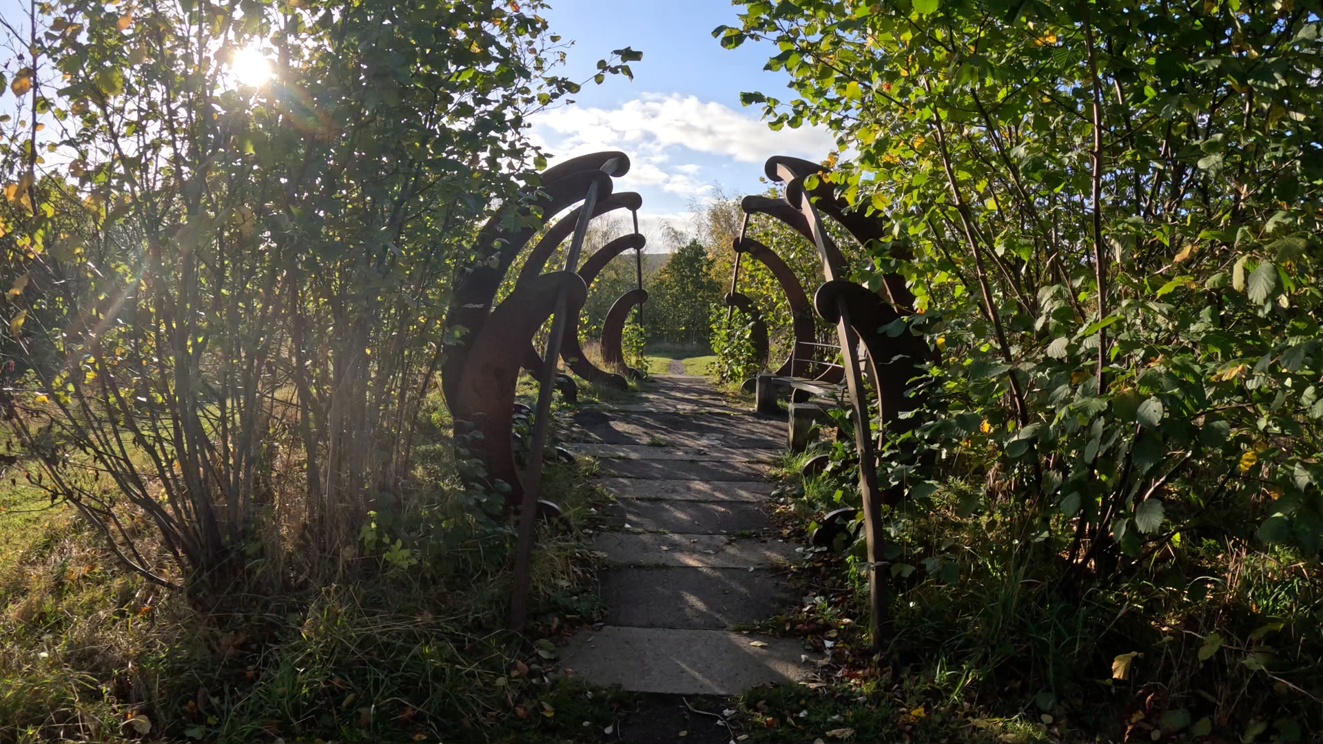
Point of Interest — The Parish Boundary Markers: Partway along the riverside path, look out for a pair of squat, rust-red iron columns. Each looks like a milk churn or chimney pot split down the middle, with “Eggleston” cast vertically on one half and “Middleton” on the other. The two halves mark the boundary between the parishes, so you step from one parish into the next as you pass between them. They are part of a public artwork by the sculptor Richard Wentworth, commissioned by Teesdale District Council in 1996 and said to be the first public art project funded by the UK’s National Lottery. Eleven pairs, 22 markers in all, stand where parish boundaries cross the Teesdale Way between Middleton and Gainford. This pair is the first in the sequence, at the top of the dale. In 2021 local photographer Elaine Vizor photographed the full set to record it for Art UK’s catalogue of public art.
Runner’s Note: Your pace here will look slow on your watch, and that’s fine. Eyes on the next three steps, short quick strides, and don’t look at the river while you’re moving. After rain, treat this section as a hike with occasional running. In autumn, wet leaves hide the roots and edges and are treacherous on the short descents, so slow down further. In snow or ice, this is the section to avoid altogether.
Into Middleton-in-Teesdale
Miles 3–4 | 4.8–6.4 km | 212–231 m | ↑ approx. 21 m ↓ 18 m | Field paths, gravel track, pavement, road
The field path keeps heading west, passing a waymark post with yellow arrows. Then it starts a gentle rise towards Middleton. A gravel track past a row of bungalows brings you onto tarmac at Leekworth Gardens, on the eastern edge of town, at around 226 metres.
You briefly touch the edge of town at around 231 metres before turning south and dropping down to Middleton Bridge, the route’s second crossing of the Tees. The road here can be busy, and the pavement switches sides near the bridge. Stay on the footway, and cross only where you can see clearly in both directions.
Point of Interest — The London Lead Company: Middleton-in-Teesdale is, in large part, a company town. The London Lead Company was chartered in 1692 and had Quaker roots. In 1815 it moved its northern headquarters here and built Middleton House. The company shaped the town around its workers, building cottages with their own gardens for employees and insisting on temperance in them. It was wound up in 1905, when its mines were sold on. Much of the stone-built town you see today grew up in its era.
Point of Interest — The Bainbridge Memorial Fountain: A short detour up into the town brings you to this ornate, Grade II-listed cast-iron fountain of around 1877, made by George Smith’s foundry in Glasgow. It commemorates a testimonial presented to R. W. Bainbridge, the London Lead Company’s agent at Middleton House, and his wife by the company’s employees and friends. Look up inside the domed canopy for the crocodiles creeping down towards the columns.
Point of Interest — Middleton Bridge: The single-arched bridge that carries the B6277 over the Tees dates from 1853. It replaced an earlier bridge of 1811 that is recorded as having collapsed before it was even finished.
Steps End to the Railway
Miles 4–5 | 6.4–8.0 km | 215–237 m | ↑ approx. 24 m ↓ 3 m | Road, farm track, riverside track, fields, stiles, road crossing
Over the bridge you head south on the B6277 before turning off down the farm drive towards Steps End. A broad track takes you back along the river for a short spell. Then the route turns away across the fields, climbing steadily through a sequence of step stiles.
Next comes the road crossing that matters. A slit stile and a walkers’ gate bring you to the B6277, where traffic moves fast. Stop fully, look and listen, and cross only when it’s clear. The route then turns right for a few metres along the road before a fingerpost leads you off over a farm drive. At around 7.4 km, a pair of concrete step stiles brings you up onto the old railway line. You’re now at around 237 metres, and the climbing is almost done.
Runner’s Note: This is a slow-burn climb, more than 20 metres gained with barely a dip, and it’s punctuated by stiles that break your rhythm. Use each stile as a reset rather than a frustration. Once you’re on the railway, the running gets easy.
Over the Lune & Home on the Old Line
Miles 5–5.68 | 8.0–9.14 km | 238–249 m | ↑ approx. 12 m ↓ 1 m | Gravel and grass trackbed, viaduct
The finish couldn’t be simpler. Turn south-east and follow the dead-straight trackbed of the old Tees Valley Railway all the way home. Right at the five-mile mark you cross the Lune Viaduct, high above the River Lune just before it joins the Tees, and the views up and down the valley are the best of the day.
From there it’s a gentle false flat on gravel and grass, rising imperceptibly to the high point of the route at the finish. You pass under a road bridge and arrive back at the old station site. If you’ve anything left, this is the place to open up. The surface is kind, the gradient barely registers and the line runs straight to the car park.
Point of Interest — The Tees Valley Railway: The branch from Cotherstone to Middleton-in-Teesdale opened on 13 May 1868 and ran for just under nine miles, with an intermediate station here at Mickleton. It was intended as the first stage of a line through to Alston that was never built. Passenger trains stopped on 30 November 1964, and freight followed in April 1965. Much of the trackbed now carries the Tees Railway Path, and the car park you started from sits on the site of the old Mickleton station.
Point of Interest — The Lune Viaduct: Built for the Tees Valley Railway in 1868, the viaduct carries the line over the River Lune on five near-semicircular arches. It is built of rock-faced stone with grey-brick arch rings, and it is Grade II listed. Its construction wasn’t without incident. In August 1867, timber supports were removed from one arch before its keystone was set, and four men were injured by falling bricks.
Runner’s Final Note: This loop is short, but it asks two different questions of you. The first half tests your footwork and patience on narrow, slippery ground above the Tees. The second tests whether you can hold an honest rhythm up a railway that never quite levels out. In between you cross the river twice, pass through one of the North Pennines’ great lead-mining towns and run over a Victorian viaduct.
It suits trail runners looking to sharpen their technical skills, road runners who want a gentle but genuine introduction to the dales, and anyone who likes their miles with a little industrial history. In summer it’s a joy. In autumn the leaves make the riverbank treacherous, and in snow and ice it’s best left for another day unless you really know what you’re doing. Respect the conditions, and always tell someone where you’ve gone. The riverbank was earned. The railway was the reward.
Map
OS Explorer OL31, North Pennines – Teesdale & Weardale
Parking
Mickleton Station Picnic Area car park, Mickleton, DL12 0JN. Free at the time of writing.
Water & facilities
No water stations on the route. Carry what you need. Middleton-in-Teesdale, at roughly the halfway point, has shops and cafés for an informal resupply. Mickleton village also has amenities, but check opening times before relying on them.
Best time to run
Best time to run: Year-round. Late spring to early autumn brings the firmest, fastest riverside running and the best valley views.
Know the risks before you go:
From late autumn to early spring the route is still open, but it is a very different proposition:
Leaf fall: Wet leaf litter on the riverside singletrack is as slick as ice and hides the roots, stones, holes and edges underfoot. On the constant short ups and downs above the river, that makes slips likely.
Mud and water: Expect deep mud on the field paths and greasy stiles. The Tees can rise fast after rain or snowmelt on the fells, so avoid the riverside section when it’s in spate.
Snow and ice: On the steps, the steep bank and the narrow path beside the river, a slip can mean a fall into the water or down the bank. In these conditions, consider avoiding the route entirely unless you are highly experienced and confident on snow and ice, with deep-lug shoes, traction devices and full safety kit.
Cold and short days: Daylight is limited and temperatures drop quickly in the dale. Start early, carry a headtorch and spare warm layers, and allow extra time, because your pace on the singletrack will be far slower than in summer.
Safety
Running alone: The riverside section is quiet in the off-season, and help could be a long time coming. Always tell someone your route and expected return time.
Always tell someone where you’re going, your route and your expected return time, especially if you’re running alone. Carry a charged phone, a warm layer, a waterproof and a whistle, plus a headtorch outside the summer months. In an emergency, call 999 and ask for the Police, then Mountain Rescue. Livestock may be present on most of the route, so follow signs, close gates and keep dogs on leads where required. Take particular care at the B6277 crossing south of Middleton and on the pavement around Middleton Bridge. Avoid the riverside section when the Tees is in spate. Wear lights and hi-vis after dark.
Elevation figures are approximate, derived from mapped route data rather than a recorded activity.
Leave a Reply