
Hawthorn Dene
& Blast Beach
A complete mile-by-mile route guide for runners and walkers
What to Expect: A route of extraordinary contrasts. You leave Seaham’s former industrial heartland, travel south along some of the finest cliff top path in the North East, plunge into the ancient woodland of a protected nature reserve, walk a beach that once starred in a Hollywood science fiction film, and climb back out to a headland with one of the best views on the Durham coast. All in under six miles.
MILE 0 — 0.5: NOSE POINT | CLIFF TOP SOUTH
Start at the Nose Point car park, at the southern edge of Seaham. This headland — known formally as Noses Point — is one of the defining landmarks of the Durham Heritage Coast, and the views from it are immediately spectacular. To your north you can see the Seaham coastline, the harbour, and on a clear day the twin towers of Seaham’s St John the Evangelist Church. To the east, the North Sea stretches away with nothing between you and Scandinavia. The dark coal-stained cliffs to your south hint at what you’re heading toward.
Nose Point itself sits on the former site of Dawdon Colliery — one of the most productive coal mines in Britain. Sunk in 1907 on the site of the old Watsontown Iron Works and blast furnaces, Dawdon was at its peak one of the most efficient pits in the entire Durham coalfield, exporting two million tonnes of coal annually by 1911. It finally closed in 1991. Almost nothing physical remains above ground now — the regeneration was comprehensive — but you are standing on the footprint of a colossus. The blast furnaces that gave Blast Beach its name once operated right here, producing pig iron from Cleveland Hills ironstone and local limestone.
Head south from the car park on the clear cliff top path. The terrain here is short-cropped grass, firm and fast underfoot in dry conditions. Elevation is roughly constant at around 35m above sea level, with the cliff edge dropping steeply to your left. Stay on the path and keep a respectful distance from the cliff edge — the limestone here is actively eroding, and the drop to the rocks and sea below is significant.
The path follows the edge of the plateau southward. The North Sea is immediately to your left throughout this section, and on calm days the views are simply breathtaking. Keep an eye out for fulmars — those stiff-winged grey-white seabirds that glide effortlessly along the cliff face, riding the updrafts without a wingbeat. They’re a constant companion on this stretch of coast, along with herring gulls and, if you’re lucky in season, the unmistakable sound of gannets diving offshore.
At approximately 0.3 miles the path passes along a stretch of regenerated cliff top grassland that is part of the Durham Coast SSSI designation. The Magnesian Limestone grassland here supports plant communities of genuine national importance — kidney vetch, wild thyme, common rock rose, and bird’s-foot trefoil are all characteristic species. The pale limestone soil chemistry creates conditions found in very few other places in Britain.
Runner’s Note This first half mile is the warm-up. Enjoy it. Take the pace easy, let your eyes adjust to the distance of those sea views, and save your legs — the route earns its keep later.
MILE 0.5 — 1.0: HAWTHORN QUARRY APPROACH | THE CLIMB BEGINS
The cliff top path begins a sustained if gradual rise through this section as you approach the high ground above Hawthorn Dene. The terrain remains open grass but the path becomes more singletrack in character — narrower, more defined, and in wet conditions considerably more technical underfoot as the chalk-soil mix can become slippery.
At around 0.55 miles you will notice the path dips slightly into a small hollow before rising again — this is where Hawthorn Burn has carved its way down toward the sea, and the subtle change in the topography marks the northern edge of the Hawthorn Dene catchment. The ground here can be notably wetter than the open cliff top you’ve just crossed.
Look inland (west) from this section and you’ll see Hawthorn Quarry — a working Tarmac-operated limestone quarry that is itself designated as a SSSI for its extraordinary geological exposures. The quarry has revealed some of the finest examples of the Magnesian Limestone stratigraphy in the North East, including an unusual algal-laminated dolomite known as the Hesleden Dene Stromatolite Biostrome — a type of geological feature found in very few locations in Britain. You won’t be running through it, but it’s worth pausing to appreciate that the rock being cut here today was being laid down under a shallow tropical sea 270 million years ago.
By mile 1.0 you have climbed to around 49m above sea level. The path continues to rise ahead of you — you are approaching the highest point of the route, just over 85m, reached at approximately mile 1.35.
Runner’s Note: Keep your effort controlled through this section. The real climb comes in the next half mile and there’s no point burning your legs here. Short stride, steady cadence.
MILE 1.0 — 1.5: THE HAWTHORN RIDGE | HIGHEST POINT
This is the most demanding climb on the outward leg. From around mile 1.0, the path pitches up noticeably as you climb from the cliff edge path onto the higher ground of the ridge above Hawthorn Dene. The ascent totals approximately 35 metres over roughly 0.35 miles, with a particularly sharp step at around mile 1.3 where the GPS profile records a 13m gain in very short distance — this is the final push to the ridge top.
At 85.3m above sea level, the high point of the route is reached at approximately mile 1.35 near the junction of the cliff top path and the upper edge of the dene. The views from here are outstanding — on a clear day you can see across Seaham Harbour to the north, south along the Heritage Coast toward Beacon Hill and Blackhall, and east over the open sea. On a still day, the silence here is remarkable for a coastline this close to a town.
From this high point the path runs along the ridge above the dene, maintaining elevation between 73m and 82m for approximately half a mile. This is one of the most exhilarating sections of the entire route for runners — fast, open, high ground with the sea hard to your left and the deep green canopy of the dene dropping away to your right. The Magnesian Limestone grassland here is at its most species-rich; look for the characteristic low-growing sward that resembles a cropped herb garden, punctuated in season with the bright yellow of bird’s-foot trefoil and the delicate purple of wild thyme.
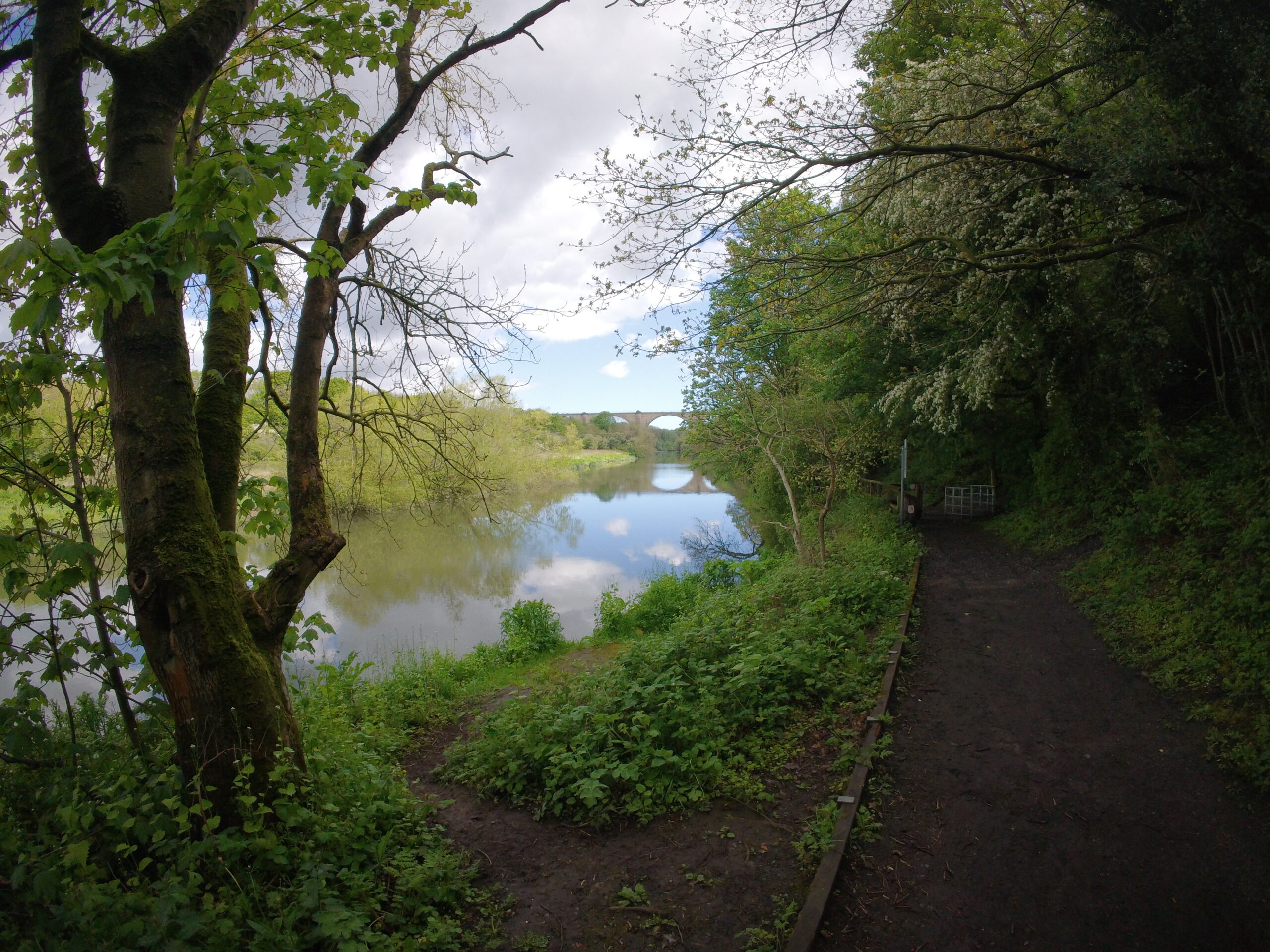
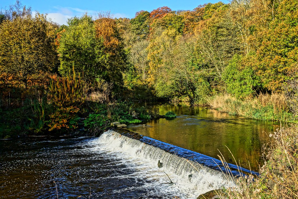
MILE 1.5 — 2.5: HAWTHORN DENE | INTO THE ANCIENT WOODLAND
This is the heart of the route and the most dramatic change in landscape character. At approximately mile 1.5, the path drops off the exposed cliff top plateau and descends into Hawthorn Dene — and the transition is immediate and total. One moment you are in open coastal wind with a sea horizon; the next you are enclosed by ancient woodland, the sound of the sea replaced by birdsong and the trickle of Hawthorn Burn far below.
The Descent
The path into the dene is steep in places and involves steps cut into the hillside. Take care — steps can be slippery with leaf litter or moisture year-round. The descent covers approximately 40m of elevation over a relatively short distance. The dene floor is reached at around mile 2.2 where the GPS profile records the elevation at approximately 39m before the path rises again into the further sections of the dene.
The path winds through the woodland following the burn valley, with the steep limestone walls of the dene rising on both sides. The route crosses and recrosses the burn in places — be prepared for stepping stones or a foot wetting if recent rain has swollen the flow.
Look out for the remains of the platform of the private railway halt that once served Hawthorn Towers — the grand country home of the Pemberton family who owned the dene until Durham Wildlife Trust’s predecessor acquired it in 1965. The towers themselves are long gone, demolished in 1969 after falling into disrepair, but the earthworks of the old walled garden and estate infrastructure can still be traced by those who know where to look.
The dene also passes beneath the impressive Victorian railway viaduct that carries the Durham Coast line — built originally to transport coal from the coastal collieries inland — before opening out eastward toward Hawthorn Hive and the coast.
The Climb
After crossing the dene floor, the path re-ascends back toward the upper level of the plateau. At approximately mile 2.6–2.7 you hit a significant drop (from ~68m to ~39m) followed by an immediate re-climb back up toward the 70–79m mark — this is the dene crossing proper, and the re-ascent is the most technically demanding sustained climb on the route. The path is steep, rooted and narrow, and in wet conditions can be genuinely challenging, shorten your stride and drive with your arms.
Runner’s Note: The dene section requires patience. It is not runnable at pace — the terrain will not allow it and the steps demand respect. Save your legs through here and
take the woodland as it is: a genuinely remarkable place that deserves more than being rushed through.


MILE 2.5 — 3.5: UPPER DENE LOOP | THE RIDGE RETURN
Having climbed back out of the main dene crossing, the route loops through the upper section of the dene complex and the magnesian limestone grassland meadows on the
seaward slopes before heading back northeast. This section is the most topographically complex of the entire route — a sequence of descents and climbs between approximately 40m and 73m as the path navigates the tributary valleys and ridgelines of the dene system.
At around mile 2.85, the path descends sharply from ~52m to ~48m before immediately climbing back through ~56m, ~62m and on to over 60m by mile 3.1. This reflects the undulating nature of the terrain at the seaward edge of the dene, where the limestone has been eroded into a series of smaller ridges and gullies.
The coastal grassland in this section is particularly rich. The magnesian limestone meadows on the eastern edge of the dene are managed as part of the Durham Coast SSSI designation — a different habitat from the woodland, but equally rare. Only an estimated 270 hectares of magnesian limestone grassland survives in the whole of Britain, with 177 hectares of that total located within County Durham. You are running across some of the most species-diverse and nationally significant grassland in England.
From the highest point of this section (~73m at mile 3.4) you are back on elevated coastal ground with wide sea views. To your north the ridge of the outward leg is
visible. The landscape here has a genuine wildness to it — wind-sculpted, open, and largely unchanged in character since before the industrial era despite being less than
two miles from Seaham.
MILE 3.5 — 4.5: RETURN CLIFF TOP | HEADING NORTH BACK TO NOSE POINT
From the high point of the return loop, the route heads northeast along the cliff top back toward Nose Point. The terrain here mirrors the outward leg in character — open
grass path, the North Sea to your right (now on your seaward side heading north), and wide views in all directions.
By mile 4.35 you are back at around 41m elevation and the silhouette of Seaham’s buildings is visible to the north. The path is faster and more open through this section — it’s the kind of terrain that, after the technical demands of the dene, feels like a reward. Legs that were tired in the woodland may find a second wind out here on the breezy cliff top.
At approximately mile 4.5 you rejoin the coast path corridor at a lower elevation (~37m), having descended from the high return ridge. Nose Point is now less than
a mile ahead of you — but the route has one more dramatic card to play first.
Runner’s Note: This is a good section to open up the stride and find your rhythm. The final descent to Blast Beach and the return climb are still ahead — use this section to prepare yourself mentally and physically for the finish.
MILE 4.5 — 5.1: THE DESCENT TO BLAST BEACH
This is the most dramatic half mile on the route. From approximately mile 4.7, the path drops sharply off the cliff top plateau to sea level — a descent of over 30 metres in roughly a third of a mile. The GPS profile is unambiguous: at mile 4.88, elevation is 31m; by mile 4.91 it has dropped to 23.7m; by mile 4.95, 10.8m; by mile 4.96, 3.7m. This is a precipitous descent by any measure.
The path uses steep cut steps in places and the surface can be loose or muddy depending on conditions. Both runners and walkers should take care here — this is not a section to rush or to attempt in inappropriate footwear. Use the steps deliberately and watch your footing on the loose material that accumulates on the path after periods of dry weather.
At the bottom of the descent you arrive at sea level and step onto Blast Beach.
Runner’s Note: Enjoy the beach. You’ve earned it. Don’t be afraid to walk it. The beach underfoot is uneven — rounded coal pebbles, shingle, and larger limestone blocks. This is not a comfortable running surface and most people walk this section even on a running day. Look around, take in the industrial geology underfoot and the cliff profile above. You are in one of the most historically significant and visually striking places on the east coast of England. The final climb is ahead — but there’s no rush right now.
MILE 5.1 — 5.71: THE FINAL CLIMB | BACK TO NOSE POINT
From the northern end of Blast Beach, the path climbs steeply back up the headland to Nose Point. This is the hardest single effort on the route — short, sharp, and
uncompromising. ~4m at mile 5.1 to ~9.7m at mile 5.49, then a rapid rise through 15m, 21m and 25m within a very short distance — a genuine sting in the tail at the end of nearly six miles.
The path back up to the car park uses a combination of stepped and unstepped terrain cut into the cliff face. The steps are well-maintained but the surface can be
loose or wet. Take it at whatever pace suits you. Most runners who attack this climb hard immediately after the beach section regret it within the first thirty seconds.
A controlled, rhythmic effort pays better dividends.
By mile 5.5 you are back at around 25–28m elevation and the car park is visible above you. The final metres are a short path back across the top of the headland to the
start point.
The route finishes at 36m above sea level — almost exactly where it started. The circular nature of the route means the total ascent and descent are almost perfectly balanced at 199m and 200m respectively — a satisfying symmetry for a route that covers so much varied ground.
Runner’s Note: This is the final push. Don’t overcook it on the steps — a twisted ankle on the last 200 metres of a route would be a miserable end to an otherwise brilliant run. Controlled effort, steady steps, and then you’re done.
ROUTE SUMMARY — AT A GLANCE
- 0.0 mi Start: Nose Point car park (36m)
- 0.5 mi Open cliff top, gradual descent to ~31m
- 1.0 mi Hawthorn Quarry visible inland, climbing begins (~49m)
- 1.35mi Route high point: 85.3m on Hawthorn ridge
- 1.5 mi Begin descent into Hawthorn Dene (~78m)
- 2.2 mi Dene floor crossing, Hawthorn Burn (~39m)
- 2.5 mi Re-climb begins, back toward plateau (~68m)
- 2.7 mi Upper dene loop, complex rolling terrain
- 3.5 mi Return cliff top heading northeast (~72m)
- 4.5 mi Lower cliff top, Nose Point approaching (~37m)
- 4.9 mi Steep descent begins to Blast Beach
- 5.0 mi Blast Beach — lowest point: 3.2m
- 5.5 mi Final climb commences back to Nose Point
- 5.71mi Finish: Nose Point car park (36m)


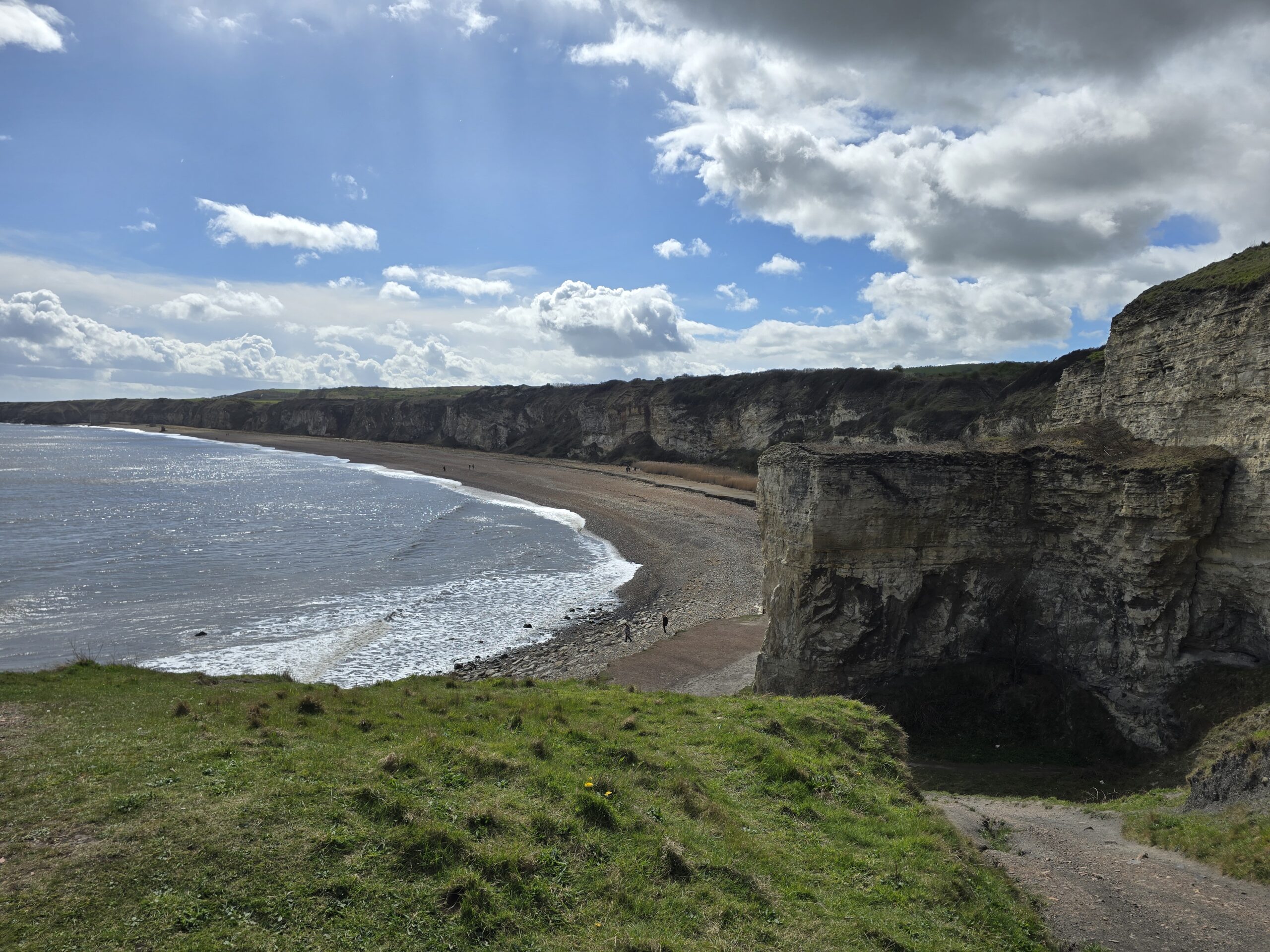
About Blast Beach; Blast Beach is one of the most historically loaded and visually extraordinary places on the entire east coast of England. Its name comes from the blast furnaces of the Watsontown Iron Works that operated here from around 1862, producing pig iron from Cleveland Hills ironstone and local Magnesian Limestone. The furnace waste was tipped over the cliff edge directly onto the beach below — an early chapter in what would become one of the worst episodes of coastal environmental destruction in British history.
When Dawdon Colliery opened in 1907 on the cliff top above, the tipping intensified. For decades, millions of tonnes of colliery spoil were dumped over the cliffs here annually. At its worst, the waste buried the beach entirely and extended 7 kilometres out to sea. Wildlife was eliminated. The water was black. The landscape was, by any reasonable measure, destroyed.
It was precisely this devastation that brought film crews here in 1992. The opening sequences of Alien 3 were filmed on Blast Beach — the production team chose it as a convincing representation of a hostile alien planet, because it genuinely looked like one. More recently, the beach has appeared in The Last Kingdom. The otherworldly
quality that attracted those productions is still there — even now, after decades of regeneration, Blast Beach has a character unlike any other beach in England.
The Turning the Tide project (1997–2002) changed everything. The colliery waste was cleared, the cliff face stabilised, and the coastal habitats given the chance to recover. What
you walk on today is a mix of the dark coal and industrial sediment that remains — which gives the beach its distinctive dark colouring — and natural shingle and
limestone fragments. The dark pebbles and sand are not pollution; they are the geological fingerprint of what happened here.
The beach is also famous for sea glass — smoothed fragments of glass from the industrial era, tumbled into jewellery- quality pieces by the action of the North Sea. Seaham sea glass is collected and traded worldwide, and Blast Beach is one of the premier locations to find it.
Look out for:
• The WWII concrete pillbox embedded in the cliff face — a reminder that this coast was considered a genuine invasion risk during the Second World War.
• The tunnel drilled through the cliff face — the drainage outlet for the Dawdon Colliery coal washing plant, built in the 1960s and still visible today.
• Red-tinged rock pools where iron compounds have stained the limestone.
• Nesting birds in the cliff cracks above — fulmars, kittiwakes and rock pipits all breed here.
Walk north along the beach toward the base of the Nose Point headland. The beach underfoot is uneven — rounded coal pebbles, shingle, and larger limestone blocks. This
is not a comfortable running surface and most people walk this section even on a running day.
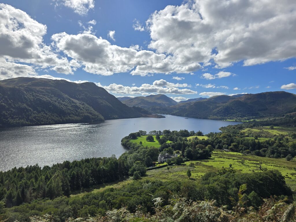
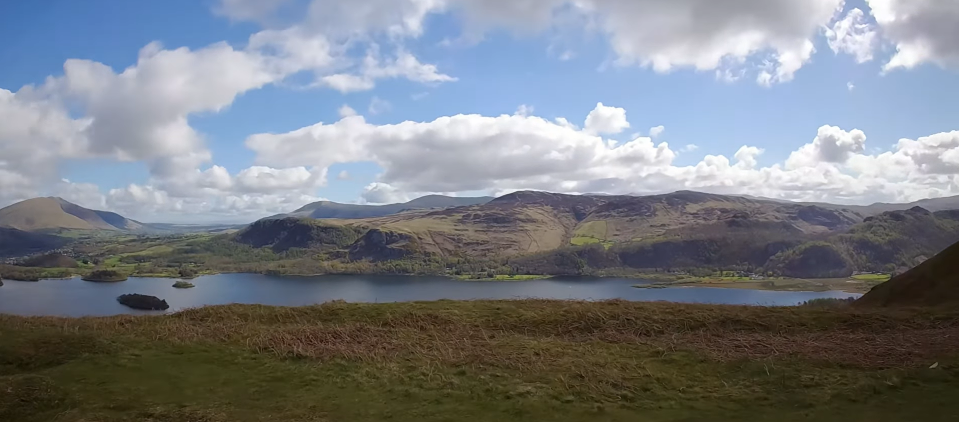
Runner’s Final Note10.66 miles. 514 metres of climbing. Moot Hall to Moot Hall — west to Portinscale, south along the western shore, up Skelgill Bank, the summit, Manesty, Lodore, the eastern shore, Friar’s Crag, home. It is one of the finest anticlockwise circuits in the Lake District. The Dog and Gun on Lake Road has been welcoming mud-covered runners and walkers through its doors for over a century. You have earned it.
After the run
Seaham is less than a mile to the north of Nose Point and has a range of cafes, pubs and restaurants for post-run recovery. The town centre has undergone significant
regeneration in recent years and is well worth an explore.
Seaham Hall Hotel, a short drive inland, is one of the North East’s finest hotels and has a spa for those who want to make a full day of it. The hotel has a direct literary connection: Lord Byron married Anne Isabella Milbanke here in 1815, in what proved to be one of history’s more disastrous marriages.
Leave a Reply