
Watergate Forest park
& Sunniside
A complete mile-by-mile route guide for runners and walkers
Distance: 9.75 km / 6.06 mi Total Ascent: approx. 165 m / 540 ft High Point: approx. 162 m / 530 ft (Sunniside) Start/Finish: Watergate Forest Park main car park, off Whickham Highway, Lobley Hill, Gateshead NE11 9RQ Start Elevation: approx. 67 m / 220 ft Estimated Time: 55–75 minutes running / 2–2.5 hours walking Terrain: Mixed: tarmac, gravel paths and woodland trail, with gates, stiles and road crossings Recommended Footwear: Road/trail hybrid
Here is a run that does more than its distance suggests. In just over six miles you start on a reclaimed colliery, rise through the woods and meadows of Watergate Forest Park, climb steadily onto the high ground at Sunniside, then let gravity carry you home along one of the oldest railway corridors in the world.
It’s a loop of two halves. The outward leg is a long, patient climb, gaining almost 100 metres between the car park and Sunniside. The return is the reward: a fast, flowing descent that drops more than 100 metres in under two miles before a flat run-in to the finish. It works as a tempo run, as a hill session in disguise, or as an easy Sunday loop with a coffee at the end. Few routes in Gateshead pack this much coal, rail and Roman history into an hour of running.
Watergate Car Park to the Lake & Meadows
Miles 0–1 | 0–1.6 km | 60–84 m | ↑ approx. 29 m ↓ 12 m | Gravel paths, tarmac
You leave the car park on the park’s well-surfaced main paths and head west into Watergate Forest Park. Settle in early. The gradient is gentle but almost constant, and the first mile is a slow, rolling rise rather than anything you’ll notice as a hill.
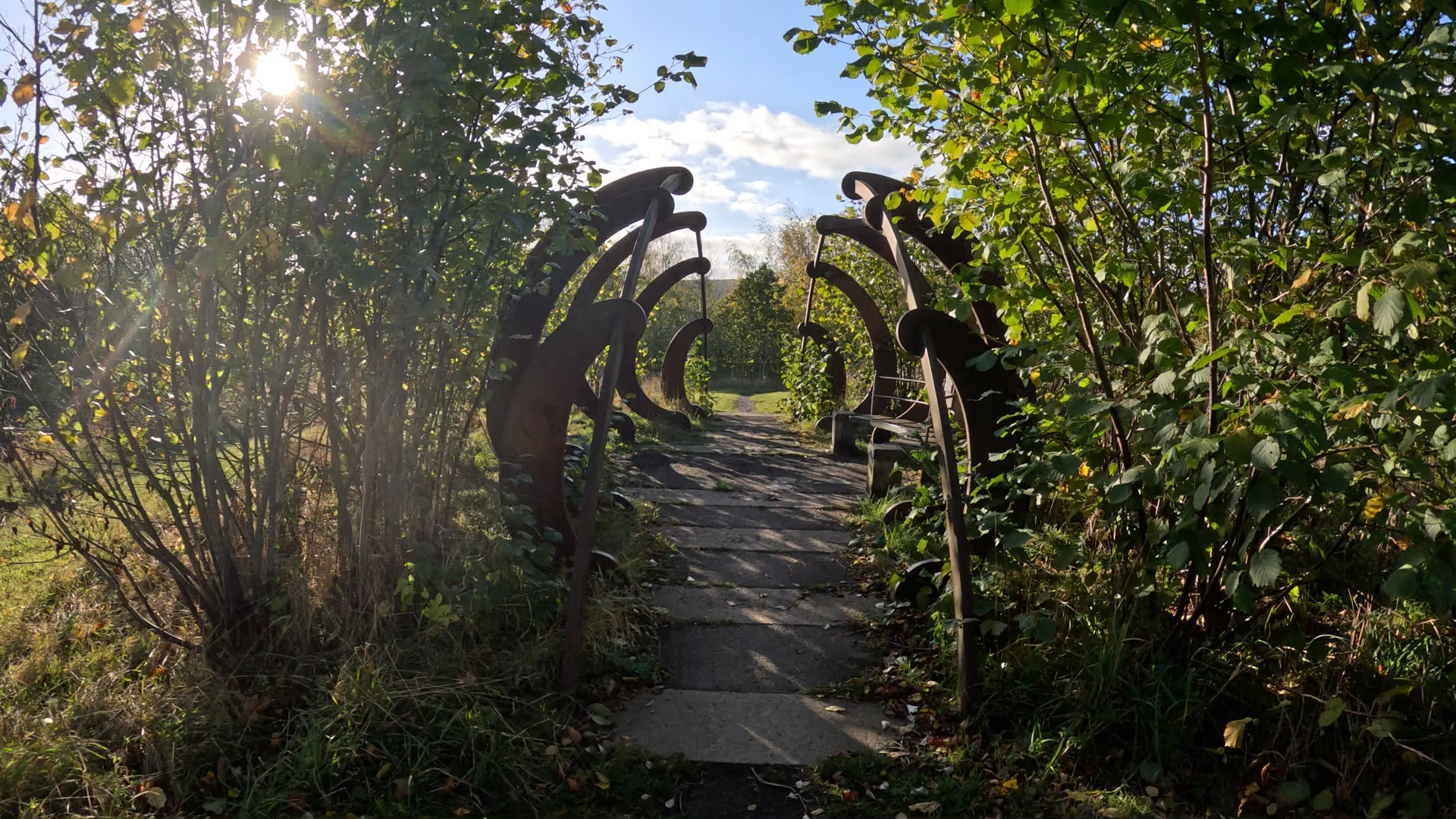
The landscape around you looks natural now, but very little of it is. The wetlands, woodland and wildflower meadows were all landscaped from former pit ground. Look out for the lake, the waterfall and the sculptures created when the site was reclaimed.
Point of Interest — Watergate Colliery: Everything here was once a working pit. Watergate Colliery opened in 1924 and was run by Priestman Collieries Ltd until the National Coal Board took over in 1947. It closed on 20 August 1964. After reclamation in the 1990s, the forest park opened on the site in 2000, and it now covers around 23.6 hectares of woods, wetland and meadow.
Runner’s Note: This is your warm-up mile, so treat it like one. The climbing starts now and doesn’t really stop until Sunniside. Go out too hard here and you’ll pay for it on mile three.
Through the Park — Washingwells
Miles 1–2 | 1.6–3.2 km | 84–104 m | ↑ approx. 32 m ↓ 19 m | Gravel paths, woodland trail
The path keeps pushing west and the surface starts to change, with smooth gravel giving way to stretches of woodland trail. There’s a little more up-and-down in this mile, short rises and dips through the trees, but the overall trend is still upwards. By mile two you’re around 100 metres above sea level.
You’re now running along the western edge of the park, close to the Washingwells woods and the old routes miners once walked to work.
Point of Interest — The Miners’ Steps: In the woods at Washingwells, Priestman Collieries built a dedicated footpath from its Broom Lane housing estate down to Watergate Colliery so that miners could reach their shifts on time. The cobbled path survives, along with a flight of “miners’ steps” built from colliery bricks stamped “APC”. Park volunteers have since uncovered a second set of steps, built in brick, stone and concrete.
Point of Interest — Washingwells Roman Fort: On the high ground just beyond the park, on a spur overlooking the Team Valley, lies a scheduled Roman fort. It is believed to date from the first Roman conquest of the region, possibly as an outpost of the late first-century Stanegate frontier. There is nothing to see on the ground. It was identified from cropmarks in aerial photographs, and the remains are buried. Still, it’s a reminder that people chose this high ground for its view of the valley long before the coal owners came.
The Climb to Sunniside
Miles 2–3 | 3.2–4.8 km | 95–147 m | ↑ approx. 58 m ↓ 7 m | Woodland trail, paths, road crossings
This is the route’s engine room. You turn south and the climbing becomes serious, with over 50 metres gained in a single mile and the steepest sections averaging around 6%. It’s not brutal, but it’s sustained, and it comes after two miles of steady uphill work.
Shorten your stride, lift your cadence and work with the gradient rather than against it. There are gates and road crossings on this stretch, so use them as natural reset points. Run what you can, hike what you can’t, and don’t be embarrassed about either.
As you climb, the trees thin and the outlook opens up. Watergate sits behind and below you, and the ground falls away northwards towards the Tyne.
Runner’s Note: If you’re using this loop as a training run, this is the mile to measure. A steady, even effort from bottom to top pays off far more than a fast start and a fade.


Sunniside — The High Point
A final push brings you to the route’s summit, at around 162 metres, on the edge of Sunniside village. You’ve climbed almost 100 metres from the car park, and from here the work is done.
The high point of the run sits right beside the northern terminus of the Tanfield Railway at Sunniside. Then you turn for home, heading north-east and downhill.
Point of Interest — The Tanfield Railway: The Tanfield Railway claims to be the world’s oldest railway. The section from Sunniside to Causey dates from 1725, and parts of the route have been in use since 1621. It was built by the Grand Allies, a group of coal-owning families, to carry coal from the Durham pits to staiths on the Tyne at Redheugh. The coal was then shipped to Shields and transferred to colliers. The route was horse-drawn for over a century, converted to steel rail from 1837, and worked by steam locomotives from 1881. The line closed in 1964, and preserved passenger trains have run since 1981. If you time your run for a Sunday you may hear steam before you see it.
The descent starts almost immediately, and the first steep pitch comes just before mile four. Here the gradient tips over to around 7% downhill, the steepest of the whole route.
Down the Old Wagonway
Miles 4–5 | 6.4–8.0 km | 58–107 m | ↑ approx. 11 m ↓ 61 m | Paths, gravel, road crossing
This is the payoff. The return leg runs in a long, almost straight line north-east back towards Watergate, dropping more than 60 metres in a single mile. The straightness is a clue to its origins: you’re running down the corridor of the old Tanfield wagonway, the route coal wagons once took off the high ground towards the Tyne.
Let the hill do the work. Keep your feet light, your cadence high and your eyes a few metres ahead, and you’ll cover this mile faster than any other on the route.
Point of Interest — Pennyfine Gates: Early in the descent, the route crosses Pennyfine Road, where level-crossing gates once stood on the wagonway. The gatekeepers were employed by the North Eastern Railway. Local records note that around 66 sets of wagons passed through each day on their way down Baker’s Bank, and that two runaway wagons crashed through the gates in January 1937. The gates are long gone, but it’s worth a glance both ways. Then cross with care: it’s still a live road.
Runner’s Note: Fast descents punish tired legs and wet surfaces. If it’s been raining or you’re running in the dark, ease off. The finish isn’t going anywhere.
Back to Watergate
The descent bottoms out back inside Watergate Forest Park, at around 52 metres, the lowest point of the whole route. From here it’s a flat, easy run-in along the park’s eastern paths, with a short final rise and a little out-and-back spur bringing you back to the car park.
If you have anything left, this is the place to open up. If you don’t, enjoy the meadows, because you’ve earned the slow mile.
Runner’s Final Note: This loop is short, but it rewards you twice: once with the honest climb to Sunniside, and again with the long, fast drop down the old wagonway. Along the way you pass a reclaimed colliery, the edge of a Roman fort and the terminus of the world’s oldest railway, all within a few miles of Gateshead town centre.
It suits newer trail runners stepping off the road, regulars looking for a midweek hill session, and anyone who wants their running to come with a little history. Finish with a coffee from the park’s café, but check its opening times before you set out. The climb was honest. The descent was earned.
Leave a Reply