
North East England · River Wear
Sunderland
& Fatfield
Loop
22 miles of raw North East grit — from the flooded clay pits of East Boldon to the Lambton Estate and back through the heart of Wearside.
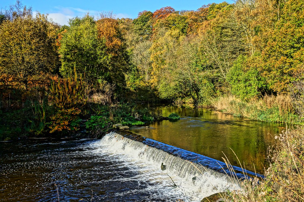
What to Expect: This route starts and finishes at the flooded remnants of a Victorian brickworks on the edge of East Boldon, and in the 22 miles between it threads together the full industrial, natural, and civic geography of the land between the Tyne–Wear border and the River Wear. You head south and west through the red-brick terraces of a former colliery village, descend to the north bank of the Wear and follow it upstream through deepening woodland toward Fatfield.
You cross at Penshaw Bridge — entering Lambton territory — then come back east on the south bank riverside trail, passing Worm Hill and directly beneath the arches of the Victoria Viaduct. From Pallion you follow the river to Sunderland city centre, crossing at the new footbridge before heading north up Newcastle Road past Fulwell Windmill and the Greyhound Stadium, and returning to Boldon.
Outward — Miles 0 to 9.1
Boldon to Penshaw Bridge
South through Boldon Colliery, descending to the north bank of the Wear. Follows the north bank upstream through Cox Green gorge, past the Victoria Viaduct. Turnaround at Penshaw/Fatfield Bridge — cross to the south bank.
Return — Miles 9.1 to 22
South Bank to City & Back
South bank riverside trail heading east past Worm Hill and under the Victoria Viaduct. Pallion, Northern Spire Bridge, Queen Alexandra Bridge, Vaux Brewery site and the new Wear Footbridge. Stadium of Light, Newcastle Road, Fulwell, home to Boldon.
MILE 0 — 1: The Tileshed — Starting at the Brickworks
The car park sits at the edge of a series of flooded clay pits — the legacy of a Victorian brick and tile works that once extracted the raw material from this land and sent it in every direction as the terraced housing stock of the industrial North East expanded. The Tilesheds Local Nature Reserve opened in 1997. Reed beds, native woodland, and marshland have colonised the old workings. The Tileshed Burn, which drains this catchment, was historically a tributary of the River Don before the extraction works altered the local hydrology.
The opening mile heads west and then southwest toward Boldon Colliery. Flat at 22–27m. Nothing technical. Mile one of twenty-two.
MILE 0.1 — 2.0: Boldon Colliery — A Parish of Miners
Boldon Colliery opened in 1869 and closed on 24 June 1982. Opened by the Harton Coal Company; owned by the National Coal Board from 1947. In 1894, 1,600 men and boys worked the Bensham and Hutton seams. The associated village grew in the standard Durham pattern: over 500 miners’ cottages in parallel terraces, chapels for the Wesleyans, the Primitives, the Free Church. The Miners’ Hall was built in 1892 for £2,000. Whellan’s 1894 directory described this simply as “a parish of miners.” The Boldon Colliery Band appeared in When the Boat Comes In in 1976 — six years after the filming, four before anyone knew the closure was coming.
MILE 2.0 — 3.0: The Plateau — First Sight of the Monument
South of Boldon Colliery the route moves through the transitional landscape between South Tyneside and the Sunderland hinterland — heading southwest across the plateau toward the Wear valley edge. Elevation climbs from 35m to approximately 40m, the highest point of the outward leg.
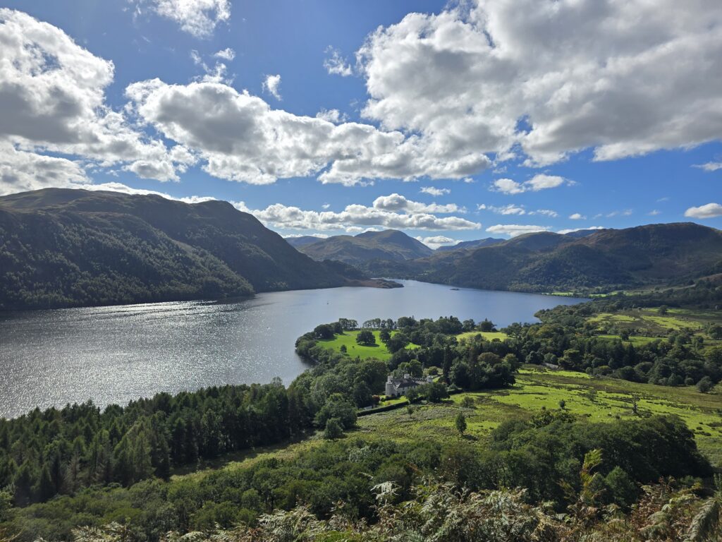
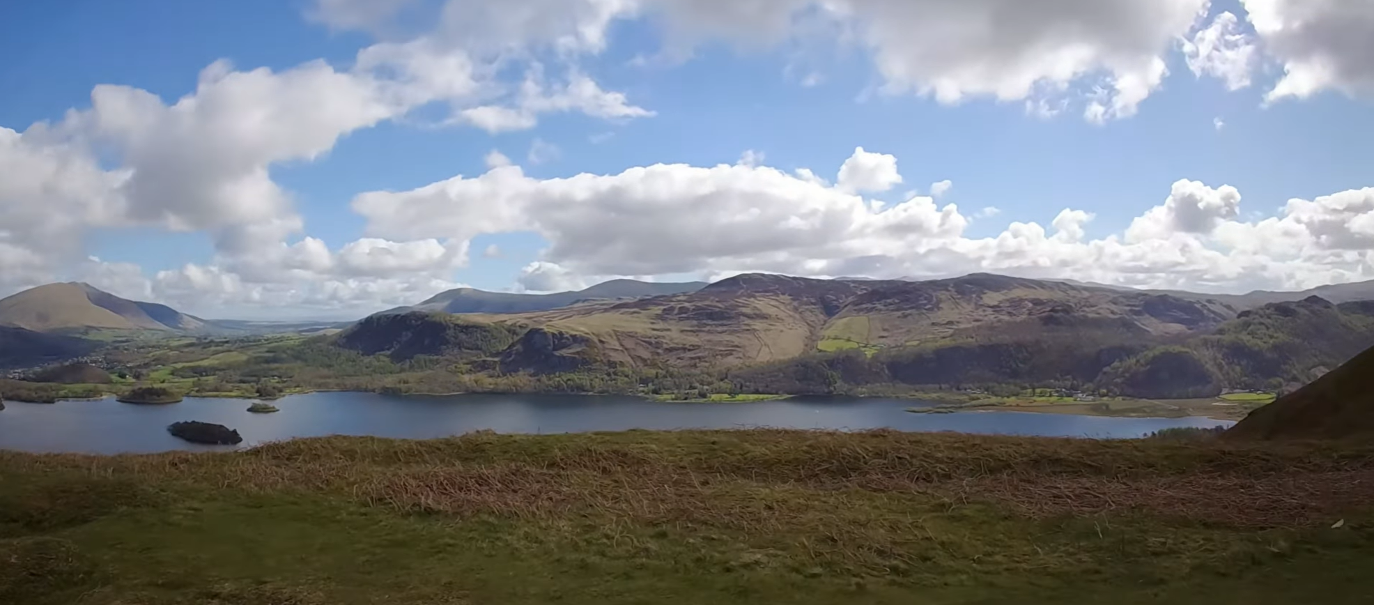
On a clear day, Penshaw Monument appears on the distant horizon: the half-size replica of the Temple of Hephaestus in Athens, built in 1844 at 136m above sea level on a hill chosen precisely to be seen from here. 21 Doric columns. National Trust. It was built by the Lambton family to commemorate John George Lambton, 1st Earl of Durham — “Radical Jack,” the man who drafted the 1832 Reform Bill and whose report became the constitutional blueprint for responsible government in Canada. The monument will be a constant presence for much of the next 12 miles. This is the first sighting.
MILE 3.0 — 5.0: Descending to the Wear — Joining the North Bank
The plateau gives way over these two miles to the Wear valley. From 40m at the high point, the route drops steadily — and in the final half mile, sharply — to join the north bank of the River Wear in the area of Hylton. The valley reveals itself gradually: woodland thickening, road noise dropping away, elevation loss steepening. At river level, the world resets. The valley walls rise on both sides. Herons stand in the shallows.
You are joining the river close to the territory of the Hylton Ferry — a crossing recorded on the Wear from at least 1322, probably earlier. Hylton Castle, the medieval gatehouse-tower built around 1400 by Sir William Hylton on a Norman predecessor, stands nearby to the east. Its west façade carries Richard II’s white hart badge. The Hylton family controlled this stretch of the river from the Norman Conquest. The male line died out in 1746. English Heritage manage the castle today. Running to the river here, you are following the same corridor that served the ferry for five centuries before the bridges came.
MILE 5.0 — 7.0: North Bank Heading West — Cox Green Gorge
The route follows the north bank upstream through the Cox Green gorge section. The river has carved deeply into the surrounding plateau, leaving steep-sided valley walls covered in ancient mixed woodland. The path weaves between the flat riverside and elevated bank sections, climbing and descending with the natural topography — 70m of combined ascent across these two miles, nothing prolonged, constantly rolling. The south bank opposite holds the Cox Green woodland proper; the north bank mirrors it.
Footing is mixed: firm gravel where established, soft and rooted where drainage channels cross. In wet conditions, this is the section that challenges your footwear choice most directly.
The Cox Green gorge was, in the 18th and 19th centuries, a working industrial landscape. The valley sides were threaded with waggon-ways — the horse-drawn precursors of the railway — carrying coal from the inland pits to the riverside staithes for loading onto keelboats. The keelboats carried the coal downstream to the sea-going colliers at Sunderland. The River Wear was one of England’s great coal arteries. The woodland has reclaimed the slopes entirely now, but the occasional widened terrace or levelled embankment in the valley sides is a ghost of the industrial infrastructure that ran where the trees stand.
MILE 5.0 — 7.0: North Bank Heading West — Cox Green Gorge
The route follows the north bank upstream through the Cox Green gorge section. The river has carved deeply into the surrounding plateau, leaving steep-sided valley walls covered in ancient mixed woodland. The path weaves between the flat riverside and elevated bank sections, climbing and descending with the natural topography — 70m of combined ascent across these two miles, nothing prolonged, constantly rolling. The south bank opposite holds the Cox Green woodland proper; the north bank mirrors it.
Runner’s Note: Footing is mixed: firm gravel where established, soft and rooted where drainage channels cross. In wet conditions, this is the section that challenges your footwear choice most directly.
The Cox Green gorge was, in the 18th and 19th centuries, a working industrial landscape. The valley sides were threaded with waggon-ways — the horse-drawn precursors of the railway — carrying coal from the inland pits to the riverside staithes for loading onto keelboats. The keelboats carried the coal downstream to the sea-going colliers at Sunderland. The River Wear was one of England’s great coal arteries. The woodland has reclaimed the slopes entirely now, but the occasional widened terrace or levelled embankment in the valley sides is a ghost of the industrial infrastructure that ran where the trees stand.
WWT Washington Wetland Centre — Miles 6.3 to 7.3. Through this section the route skirts the northern and western boundary of the WWT Washington Wetland Centre — 45 hectares of wetland, ancient woodland, reedbeds, and wildflower meadow sitting right on the north bank of the River Wear. Managed by the Wildfowl and Wetlands Trust since 1975, the reserve hosts the largest grey heron nesting colony in the region, alongside breeding avocet, lapwing, and curlew — with flocks of 500 curlew recorded at Wader Lake in season. The ancient Spring Gill Wood is carpeted with bluebells, primrose, and wood sorrel in spring. Chilean flamingos, black-necked swans, and Asian short-clawed otters are resident year-round, while the reedbeds support reed bunting, reed warbler, sedge warbler, and water rail. Running the north bank path at this point, the woodland and wetland habitat of the reserve bleeds seamlessly into the natural corridor of the route — a reminder that the industrial gorge and the conservation reserve share the same stretch of river. Open 364 days a year. wwt.org.uk/wetland-centres/washington ↗
MILE 7.0 — 8.5: The Viaduct Corridor — First Approach
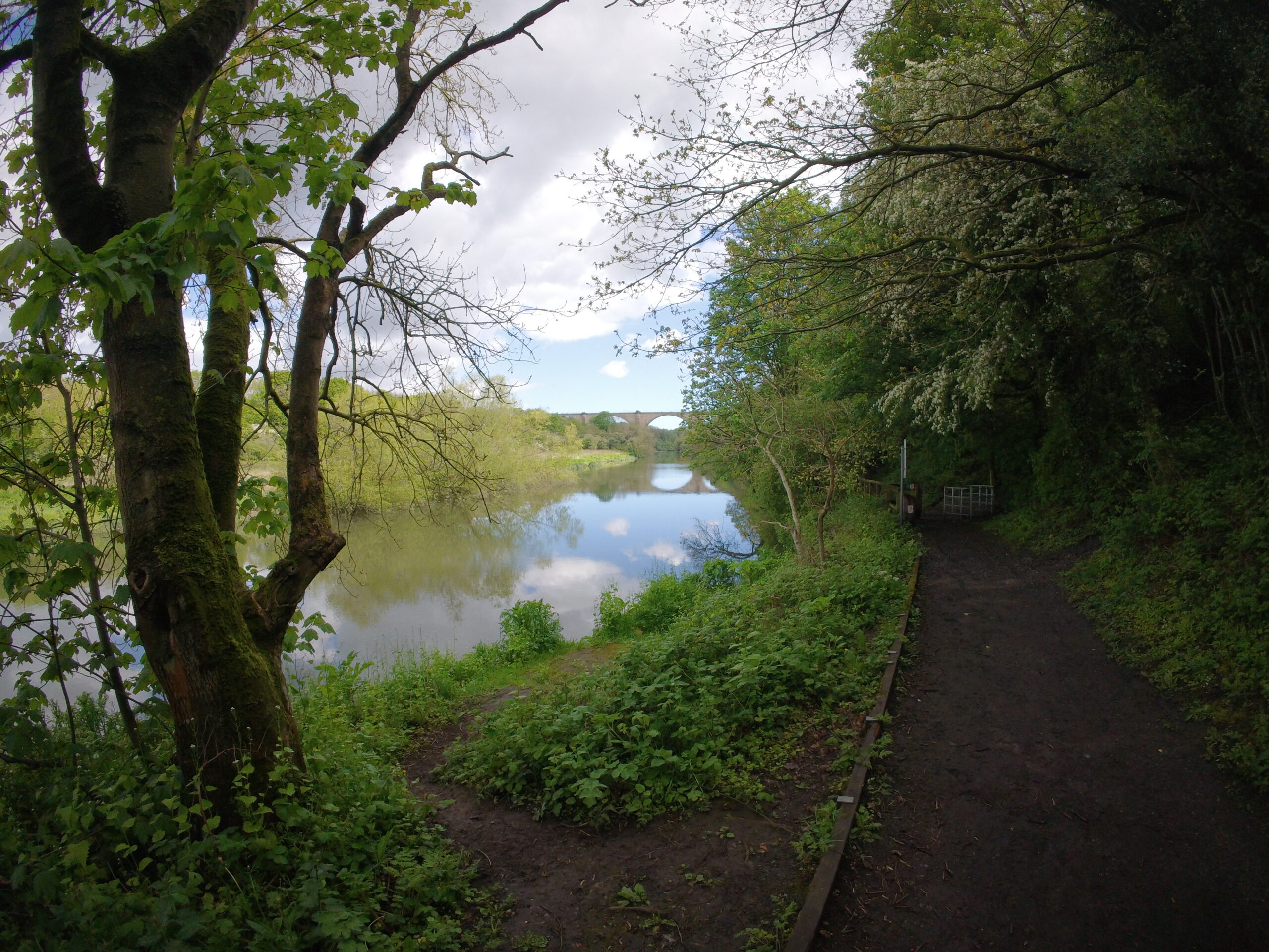
The route descends from the elevated woodland bank back to river level as a distinctive shape resolves itself to the west. The Victoria Viaduct — ten sandstone arches, 120 feet above the water — appears ahead. Built 1836–38 for the Durham Junction Railway under engineer Thomas Elliot Harrison. Ten sandstone arches, 810 feet (247m) total span, individual spans up to 160 feet (49m), piers sunk 40 feet into the riverbed. The stone is Penshaw sandstone, quarried on the hill whose monument watches over the route. The final stone was laid 28 June 1838 — Queen Victoria’s Coronation Day, and the structure was named in her honour. Its design was based on the Roman Alcántara Bridge in Spain, built under Emperor Trajan in 104–106 AD. The inscription on that bridge reads: Pontem perpetui mansurum in saecula — “I have built a bridge which will last forever.” The Victorians felt similarly. Grade II* listed. Mothballed since 1991. Still standing.
On the outward leg the route passes within approximately 130m heading west, seen in profile from the same bank. The scale is not fully legible at this distance. That reckoning comes on the return.
MILE 8.5 — 9.0: Fatfield — The Turnaround Approaches
The final mile of the outward runs flat along the north bank at 5–10m elevation through the Fatfield area. Easy running, wide path, the river alongside. Penshaw Monument is now a much closer and larger presence on the skyline to the south, the columns visible rather than inferred. You are in the Lambton valley. The land here was the Lambton Estate for centuries — mine-owning, coal-exporting, historically significant.
Here the route crosses from the North Bask to the South Bank, ocver Penshaw / fatfield bridge. Road bridge opened 29 January 1890, linking Penshaw on the south bank with Fatfield on the north. Opened by the Earl of Durham. This is the geographical and narrative pivot of the route — cross to the south bank and begin the return.
MILE 9.0 — 10.0: Worm Hill & Victoria Viaduct — The Return’s Opening
Cross the bridge and turn east. Within three-quarters of a mile, the return delivers its two most significant moments in rapid succession.
Mile 9.77 — Worm Hill. Directly across the river on the north bank, rising from the flat as a distinctive glacial mound: Worm Hill. Young John Lambton skipped church to fish the Wear. He caught something — eel-like, dragon-headed, nine holes on each side of its face — and threw it down a well at this hill. He went to the Crusades. The creature grew. By the time he returned it was coiling around Penshaw Hill seven times and devastating the local population. He killed it — but failed to keep a promise, and the Lambton family was cursed for nine generations. The hill is approximately 180m across the water. It is a real geological feature, a real place, and a real legend attached to this specific location for centuries.
Mile 9.86 — Victoria Viaduct. Forty-six metres from the route’s closest point. You are now below the arches from the south bank rather than looking at them from the side. Ten spans of Penshaw sandstone rise 120 feet above the water. The perspective at river level makes the scale undeniable. The Victorian engineers who built this in 1836–38 were not making something functional. They were making something permanent.
MILE 10.0 — 14.0: South Bank Riverside Trail — Cox Green to Pallion
From the Victoria Viaduct the south bank trail heads east, beginning its long return toward Sunderland. The trail runs close to the Wear through the southern edge of the Cox Green woodland — valley sides rising on both banks, the river running clear and fast over occasional bedrock. Kingfishers use this stretch. Grey wagtails and dippers work the waterline.
Miles 10–13 stay broadly at river level (4–17m). Around miles 13–14 the path climbs more decisively, gaining 25m over less than half a mile as the trail transitions from the riverside to an elevated path above the valley — the beginning of the approach to Pallion and the city
The south bank between Fatfield and Pallion was part of the Lambton Estate. John George Lambton drafted the 1832 Reform Bill and authored the Durham Report of 1839 — the constitutional blueprint for responsible government in Canada. He is buried at the estate. The Penshaw Monument on the hill to your south was built four years after his death.
Pallion Hall, ahead on the south bank, was the birthplace in 1828 of Joseph Swan — the physicist who invented the incandescent light bulb. Swan patented his carbon filament lamp in November 1879, just months before Edison filed his American patent. The house is gone. The inventor of electric light was born within sight of this path.
MILE 14.0 — 15.0: THE DESCENT TO BLAST BEACH
Around mile 14.5 the route reaches the Northern Spire Bridge at Pallion, and the character of the run changes completely. The riverside trail is exchanged for the shared pedestrian and cycle path running alongside the A1231. From this point the route follows the road and river eastward into the city.
This two-span cable-stayed bridge carries the A1231 over the River Wear between Pallion (south) and Castletown (north). Its central A-frame pylon rises to 105 metres — the tallest structure in Sunderland and the tallest bridge in the North East. The Northern Spire opened on 28 August 2018: the first new bridge across the Wear in more than 40 years. More than 10,300 votes were cast by local people to name it. Arriving at it from the enclosed riverside trail — rounding a corner from the gorge woodland to find a 105m cable-stayed structure directly overhead — is one of the most abrupt and effective tonal changes on the entire route.
MILE 15.0 — 16.0: Under the Queen Alexandra Bridge — Pallion to Deptford
The route follows the road and river east through Pallion and Deptford toward the city centre. At approximately mile 15.35, the path passes beneath the Queen Alexandra Bridge — a Grade II listed steel truss bridge of a completely different character to the Northern Spire: massive, dark, Victorian, carrying the weight of more than a century of use.
Built as a combined double-deck rail and road bridge, the upper railway deck was last used in 1921. Built by Sir William Arrol & Co. — the same firm that built the Forth Bridge and Tower Bridge — at a cost of £450,000. Designed by Charles A. Harrison. Officially opened on 10 June 1909 by the Earl of Durham, on behalf of Queen Alexandra. When it opened, it was the heaviest bridge in Britain. Built to carry coal from the Washington and Annfield Plain coalfields to Sunderland’s south docks. Passing beneath its structure, you move from the Victorian industrial edge of Sunderland into the city proper.
MILE 16.0 -16.5: The Former Vaux Brewery — City Centre, South Bank
The route reaches the former Vaux Brewery site — now Keel Square, the centrepiece of the Riverside Sunderland development. The brewery closed on 2 July 1999 after 162 years of production. Founded by Cuthbert Vaux in 1806. Around 700 jobs were lost — imposed by London financiers despite the brewing arm generating £50 million annual profit. The site stood derelict for years before regeneration began. The Beam, City Hall, and new residential blocks now stand where the brewery once dominated the skyline. The approach to the New Wear Footbridge ramps up from 24m to approximately 36m as you climb to the bridge deck level. £31 million pedestrian and cycle bridge connecting Keel Square (former Vaux Brewery, south) to the Sheepfolds (north, adjacent to Stadium of Light). Part of the £500 million Riverside Sunderland development. Opened 2024–25. From the deck: downstream Wearmouth Bridge, upstream Northern Spire and Queen Alexandra — the Wear’s crossings in a single sightline.
MILE 16.5 – 17: Stadium of Light — The Colliery Ground
At mile 16.94 the route passes w the Stadium of Light. The stadium opened in 1997 on the site of Wearmouth Colliery, which closed in December 1993 after extending its workings for miles beneath the North Sea. A Davy Lamp — the miner’s safety lamp invented in Sunderland — stands outside and gives the stadium its name. The first game was a 0-0 draw against Ajax. The Wearmouth Colliery is gone. The Davy Lamp acknowledges what was here before. This is not a footnote — it is the primary text of why this ground exists at this location.
The route picks up Newcastle Road (A184) heading north around mile 17 — the spine of Sunderland’s north side, running toward South Shields and the coast.
Mile 17.0 – 17.5: Newcastle Road — Three Football Grounds
Along Newcastle Road north of the Stadium of Light, the route passes through a concentration of Sunderland AFC history. Roker Park — the club’s home from 1898 to 1997 — stood just west of Newcastle Road at approximately mile 17.4. Record crowd of 75,118 for an FA Cup match in 1933. Demolished in 1998. Now housing; the streets named after former players. Just south of the Roker Park site, the Newcastle Road Ground stood from 1886 to 1898 — where the club earned the nickname “The Team of all the Talents” and won four First Division titles in six seasons. Both grounds are gone. Both sites are passed within a few hundred metres of each other on this section of road.
Mile 18.0 – 18.5: Fulwell Windmill — Route’s Highest Point
The route climbs along Newcastle Road through Fulwell, reaching the highest point of the entire run at 45.7m at mile 18.28. At approximately mile 18.5, the route passes the Fulwell Windmill on the west side of Newcastle Road — a historic stone tower windmill and one of Fulwell’s defining landmarks. On a clear day from this elevation, Penshaw Monument is visible to the southwest — the same structure that first appeared on the horizon at mile 3. Fourteen miles lie between those two sightings.
Mile 18.5 – 20.0: Sunderland Greyhound Stadium — The Boldon Road
The route descends from Fulwell along the Newcastle Road corridor toward the South Tyneside border. At approximately miles 19–20, the Sunderland Greyhound Stadium appears on the east side of Newcastle Road — the 378-metre track at Fulwell that opened in 1940 as the Boldon Greyhound Stadium, built where Newcastle Road and Sunderland Road converged, parallel to the London & North Eastern Railway on its north side. Still operating under the Arena Racing Company, Wednesdays and Fridays. One of those pieces of civic infrastructure that exists so quietly beside its arterial road that most people driving past have never really looked at it. At mile 19 of 22, there is a particular quality of attention available that the car cannot offer.
Mile 20.0 – 22.0: Return to the Tileshed — East Boldon
The route crosses from the City of Sunderland into South Tyneside, the settlements loosening slightly, the green space widening, the plateau edge of Boldon returning. The final approach follows Tileshed Lane back to the reserve. The flooded clay pits appear again: the same reed beds, the same still water, the same industrially-derived nature that opened the run 22 miles ago. The brickworks that became a nature reserve is a reasonable metaphor for what the whole route has been exploring — the process by which the industrial North East has been gradually reclaimed, converted, memorialised, and to some degree forgotten, while the landscape it left behind becomes something else entirely.
Notes
Runners & WalkersFootwear
Trail shoes for all conditions outside dry summer. The south bank riverside trail (miles 9–14) and the north bank outward (miles 5–9) can be waterlogged after rain. Both sections sit on the floodplain and drain accordingly.
The Victoria Viaduct Appears Twice
Outward at mile ~8.4 from the north bank heading west (130m, in profile). Return at mile 9.86 from the south bank heading east (46m, beneath the arches). Both are worth slowing for. The return is the closer encounter.
Bank Crossings
The outward is on the north bank. At Penshaw Bridge (mile 9.1) you cross to the south bank. You remain on the south bank through to the New Wear Footbridge (mile ~16.5), where you cross back north. Two crossings, both in the return half.
Resupply
Boldon Colliery (mile ~1) has shops. Limited options on the riverside (miles 5–14). Pallion/city area (mile ~15–16) and Stadium of Light (mile 17) offer the best mid-to-late resupply points.
Wildlife
Tileshed ponds: reed bunting, sedge warbler, teal, pochard. River corridor (miles 5–14): kingfisher, grey wagtail, dipper, heron. The Wear’s salmon and sea trout population has recovered substantially since industrial effluent controls improved in the 1990s.
Distance
GPS-calculated distance is 21.4 miles. Strava records 22 miles with smoothing applied. Budget 3.5–4.5 hours for runners at trail pace; 7–9 hours for walkers covering the full route.
Elevation Summary
Full Route Profile| Section | Detail | Elevation |
|---|---|---|
| Miles 0–1 | Tileshed to Boldon Colliery | 23–27m |
| Miles 1–2 | Through Boldon Colliery village | 27–35m |
| Miles 2–3 | Plateau — outward high point | up to 40m |
| Miles 3–5 | Descent to north bank, River Wear | 40m → 6m |
| Miles 5–9 | North bank heading west, Cox Green gorge | 4–25m |
| Mile 9.1 | Penshaw/Fatfield Bridge — cross north to south | 5m |
| Miles 9–10 | Worm Hill and Victoria Viaduct | 5–12m |
| Miles 10–14 | South bank riverside trail heading east | 4–35m |
| Mile ~14.5 | Northern Spire Bridge — join road | 20m |
| Mile ~15.35 | Pass under Queen Alexandra Bridge | ~20m |
| Miles 16–16.5 | Former Vaux Brewery, New Wear Footbridge approach | 24–36m |
| Mile ~16.5 | New Wear Footbridge — cross south to north bank | 36m |
| Miles 16.5–17 | Sheepfolds, Stadium of Light, Newcastle Road | 30–35m |
| Mile 18.28 | Highest point of entire route — Fulwell | 45.7m |
| Miles 18.5–20 | Fulwell Windmill, Greyhound Stadium | 22–38m |
| Miles 20–22 | Return to East Boldon, Tileshed finish | 22–27m |
Leave a Reply